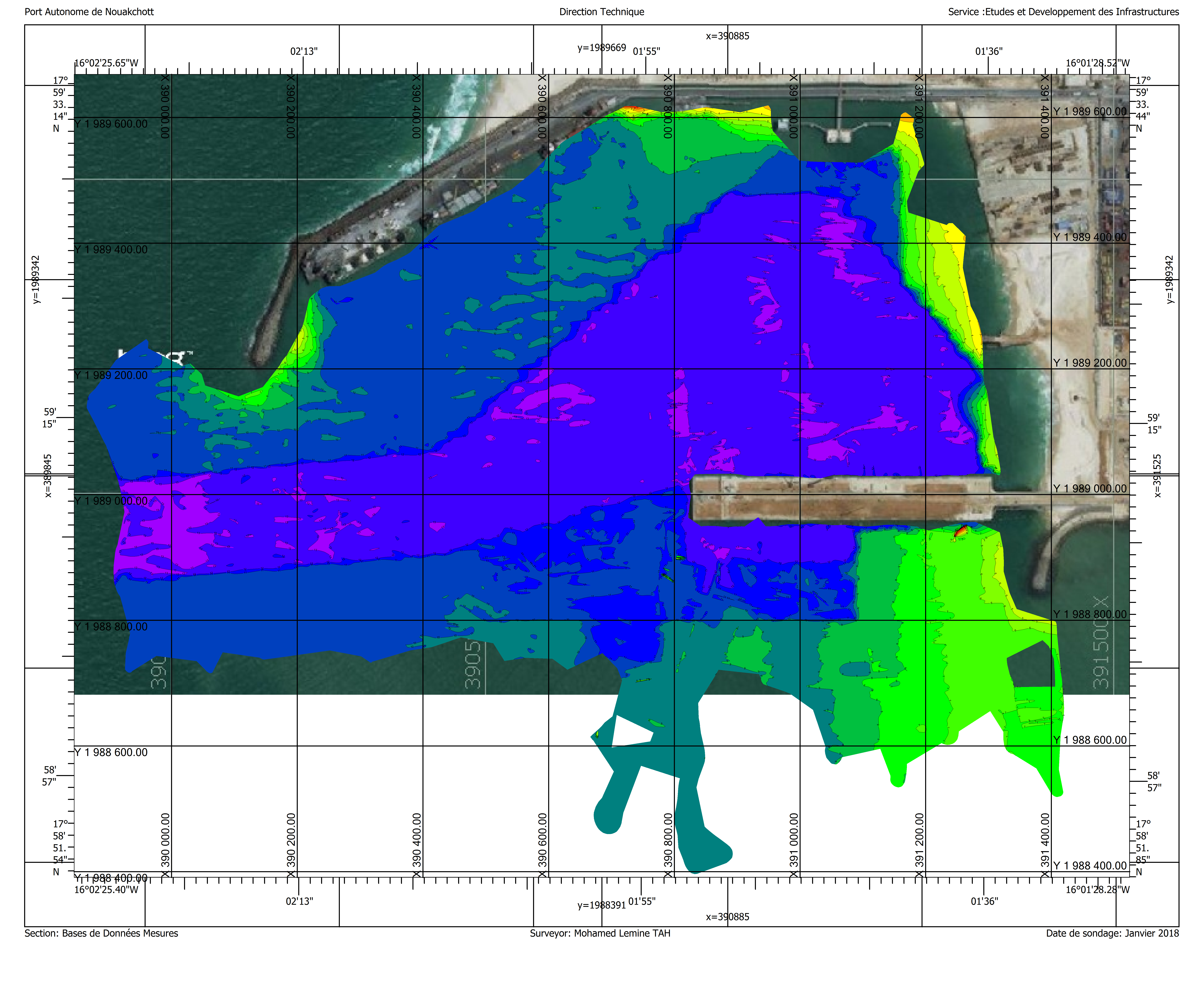

The Department of Studies and Infrastructure Development in the Port of Nouakchott (Data and Measurements Department) conducts sounding operations to map depths and marine topography.
These maps aim to:
- Ensuring the security of navigation in the port waters (berths, canals, roundabouts);
- Evaluate the amount of sediment that needs to be removed when carrying out dredging operations.
In order to explore the depths of the sea, the port has a special ship equipped with the necessary equipment for this purpose:
- Monospectral probe;
- A distance positioning device in centimeters;
- HIPAC software.
These acoustic resonance and positioning systems make it possible to highlight terrain features in the marine depths.
The analysis of the data obtained, through the competencies available to the Authority, enables the crystallization of maps of sea water at the port level, some of which are presented below:
Do you want to know more about our port?
Do not hesitate to call us